In a crowded city, anonymising the data is effective because there are so many people in the area that it is virtually impossible to identify the movement patterns of any individual. However, as there are relatively few app users at sea (or in other remote areas) it becomes possible to follow the movement patterns of just one app user.
Don’t be too alarmed. Because assets in our industry tend to move around and because the heat map includes all data from 2009 to September 2017, the security implications for our industry are probably not as serious as they at first appear, but this release of information is still a good reminder that our apps often share far more information about us than we realise.
For operations with fixed locations the implications are more serious. This story from the BBC shows how the exercise patterns of soldiers unintentionally map military bases.
Some interesting examples from our industry
Off the coast of Côte d’Ivoire we can see the locations of offshore operations lit up like specs (bottom right) by the athletic activities of those using the Strava app onboard.
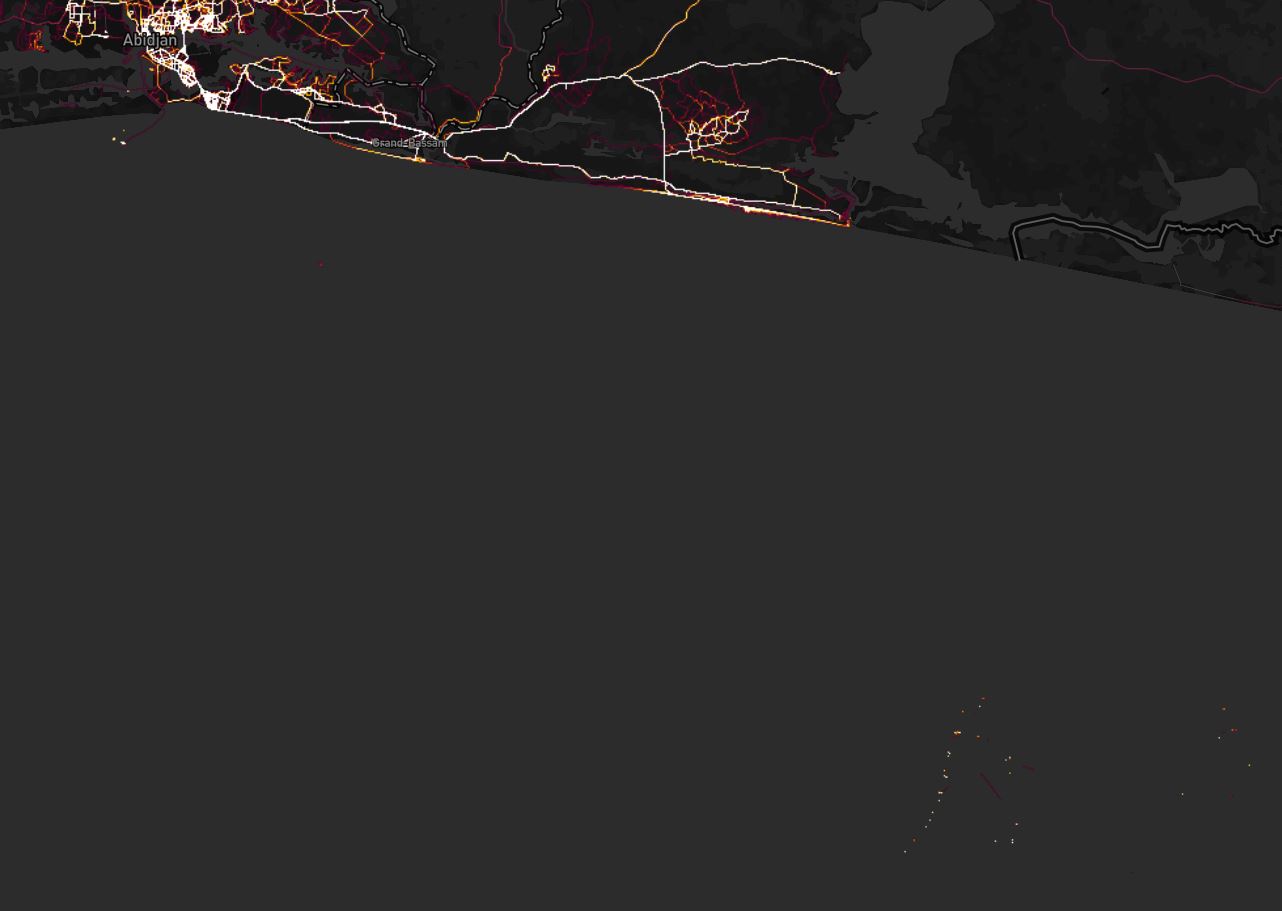
Zoom in on any of these points and the circular routes the app users are following onboard becomes visible. Also revealed is the movement of those offshore assets which did not remain fixed.

Further along the cost, in the anchorage off of Lomé, Togo we can see the activity on vessels sitting at anchor. We see both the swing of these vessels on their anchors and the tracks that the people on board make as they exercise (or perform their duties with the app on) around the perimeters of the vessels.

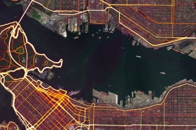
In Vancouver, Canada, we see something different, the path of the SeaBus back and forth across Vancouver harbour. The tracks of this commuter ferry appear as a dark purple smudge (center) which comes to a point at either end of the ferry’s voyage, and appears to bulge out in the middle showing the varying paths that the vessel takes over time as it manoeuvres around other traffic in the harbour.
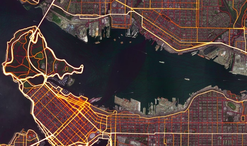
You might ask yourself, is anyone actually exercising on the SeaBus? Probably not, but people likely forget to turn off their app and because the speed of the SeaBus is similar to the speed that people might cycle or even run at, the app will assume that the users are still exercising and track the activity across the harbour.
In our modern world, it is impractical to expect people not to use mobile devices. Even if they are completely banned on board, it is likely that people will continue to use them. Instead of trying to restrict use, we must focus on educating people about their privacy choices. Privacy options available on almost all apps and platforms can make a big difference. If seafarers using Strava had been educated to activate the privacy features on the app, we would not be able to see these tracks today.
For anyone interested in learning more about how the heat map was created, full details can be found here.
Dustin Eno
COO & Crisis Response Manager
T: +44 (0)20 3326 8467
E: dustin.eno@navigateresponse.com
Twitter: @dustineno